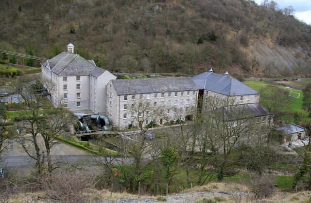
Cressbrook Mill
Introduction
The photograph on this page of Cressbrook Mill by Chris Allen as part of the Geograph project.
The Geograph project started in 2005 with the aim of publishing, organising and preserving representative images for every square kilometre of Great Britain, Ireland and the Isle of Man.
There are currently over 7.5m images from over 14,400 individuals and you can help contribute to the project by visiting https://www.geograph.org.uk

Image: © Chris Allen Taken: 17 Mar 2012
This former cotton mill is now converted to houses and usually referred to as Cressbrook Mill. It is in fact three conjoined mills of different ages. On the left with the cupola is Wye Mill of 1814. On the right with two roof ventilators is Cressbrook Mill of 1823. Between them is Arkwright's Mill of 1783 and rebuilt in 1787 following a fire in 1785. In the angle between Wye Mill and Arkwright's Mill are two derelict water turbines. I was completely unaware of them until I first followed this path and gained some elevation and then I recognised them immediately.

