Old Bridge Marker
Introduction
The photograph on this page of Old Bridge Marker by Alan Rosevear as part of the Geograph project.
The Geograph project started in 2005 with the aim of publishing, organising and preserving representative images for every square kilometre of Great Britain, Ireland and the Isle of Man.

There are currently over 7.5m images from over 14,400 individuals and you can help contribute to the project by visiting https://www.geograph.org.uk
Old Bridge Marker
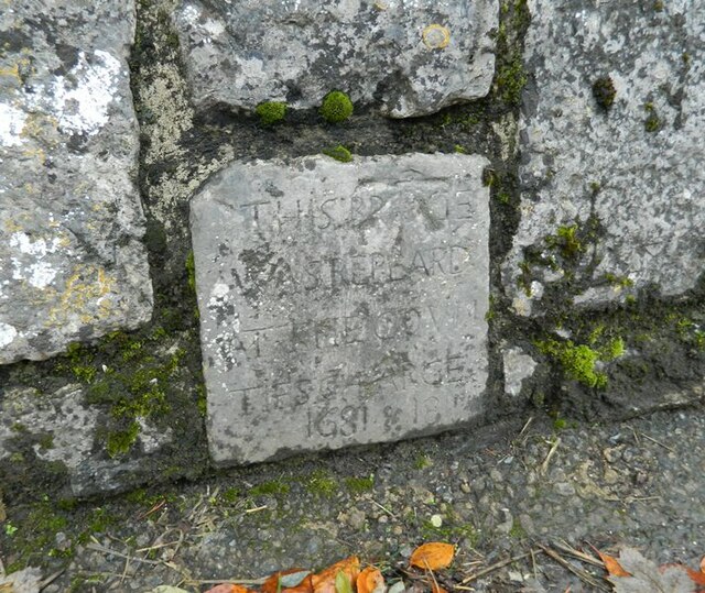
Image: © Alan Rosevear Taken: 17 Nov 2012
Bridge Marker set in the south parapet of Bridgeland Bridge, Kate Brook, on Clifford Street. Chudleigh parish. Inscribed THIS BRIDGE / WAS REPEARD / AT THE COUN / TIES CHARGE / 1681 & 1811 Carved benchmark The bridge is Grade II Listed, details https://historicengland.org.uk/listing/the-list/list-entry/1097098. See also http://www.flickr.com/photos/tollhouses/8192460041 and https://www.geograph.org.uk/photo/6658927. Milestone Society National ID: DV_CHAC02br
Images are licensed for reuse under creativecommons.org/licenses/by-sa/2.0
Image Location
Latitude
50.602476
Longitude
-3.596592