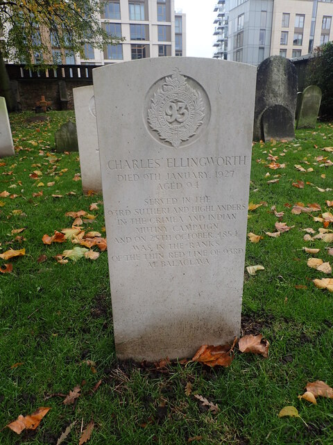
Grave of Charles Ellingworth, Brompton Cemetery
Introduction
The photograph on this page of Grave of Charles Ellingworth, Brompton Cemetery by Marathon as part of the Geograph project.
The Geograph project started in 2005 with the aim of publishing, organising and preserving representative images for every square kilometre of Great Britain, Ireland and the Isle of Man.
There are currently over 7.5m images from over 14,400 individuals and you can help contribute to the project by visiting https://www.geograph.org.uk

Image: © Marathon Taken: 29 Oct 2020
Brompton Cemetery is one of 'The Magnificent Seven' cemeteries and is the closest of the major cemeteries to the centre of London. Opened in 1836 on land owned by Lord Kensington, its original layout was based on the plan of a vast cathedral, with a chapel in the middle based on St Peter's Basilica in Rome. It was extended in 1844 to make the plot a full rectangle. In 1850 the government agreed to purchase all the London cemeteries, which was fortunate for Brompton as the original plan had been ruinously expensive. That edict was repealed two years later, except in the case of Brompton which by this quirk remains the only public cemetery to stay under government control and is now managed by The Royal Parks. Among many other campaigns, Charles Ellingworth saw action in the Crimea, including the glorious 'Thin Red Line' of Balaklava, of which he was known to be the last survivor. This gives more detail about the life of Charles Ellingworth http://www.theargylls.co.uk/battlebalaklava.php

