Melton village sign
Introduction
The photograph on this page of Melton village sign by Adrian S Pye as part of the Geograph project.
The Geograph project started in 2005 with the aim of publishing, organising and preserving representative images for every square kilometre of Great Britain, Ireland and the Isle of Man.

There are currently over 7.5m images from over 14,400 individuals and you can help contribute to the project by visiting https://www.geograph.org.uk
Melton village sign
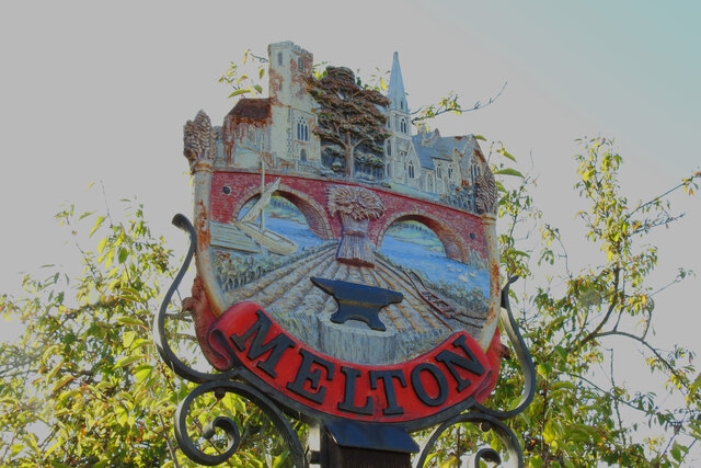
Image: © Adrian S Pye Taken: 22 Oct 2020
A sign with many aspects to recognise. The two churches are most prominent at the top, separated by a large tree as in the churchyard at the new church, only a short distance from this sign. The old church, located midway between Melton and Ufford is still in use and for hire as a venue for any occasion. Wilford Bridge over the River Deben looms large in the picture, complete with a sailing barge. A wheatsheaf, ploughed field, ice cutting plough and blacksmith's anvil complete the picture of Melton past and present. https://www.geograph.org.uk/photo/6648814
Images are licensed for reuse under creativecommons.org/licenses/by-sa/2.0
Image Location
Latitude
52.10652
Longitude
1.332024