The Old Manor
Introduction
The photograph on this page of The Old Manor by Ian Capper as part of the Geograph project.
The Geograph project started in 2005 with the aim of publishing, organising and preserving representative images for every square kilometre of Great Britain, Ireland and the Isle of Man.

There are currently over 7.5m images from over 14,400 individuals and you can help contribute to the project by visiting https://www.geograph.org.uk
The Old Manor
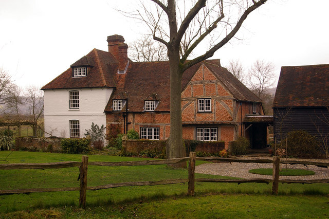
Image: © Ian Capper Taken: 20 Jan 2008
A beautiful Grade II* listed house on the rural edge of Reigate, the original part of which dates from the 15th century, with the cross wing on the right being mid/late 16th century and the extension to the left being 18th century. For listing particulars see www.historicengland.org.uk/listing/the-list/list-entry/1029144. The barn to the right is 16th century and is Grade II listed.
Images are licensed for reuse under creativecommons.org/licenses/by-sa/2.0
Image Location


Leaflet Map data © OpenStreetMap
Latitude
51.24467
Longitude
-0.228449