Douniefell with west entrance to Ship Hole
Introduction
The photograph on this page of Douniefell with west entrance to Ship Hole by Nigel Feilden as part of the Geograph project.
The Geograph project started in 2005 with the aim of publishing, organising and preserving representative images for every square kilometre of Great Britain, Ireland and the Isle of Man.

There are currently over 7.5m images from over 14,400 individuals and you can help contribute to the project by visiting https://www.geograph.org.uk
Douniefell with west entrance to Ship Hole
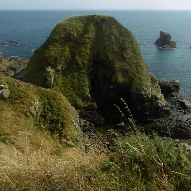
Image: © Nigel Feilden Taken: 27 Aug 2019
This is a nearly stack/island which is part of the intertidal area below Seacliff, Muchalls. The entry to Ship Hole - shown as a subterranean passage on the 1902 version of the 25 in/mile OS - about central, but in shadow. The top of Douniefell is a Canmore site 37225 'enclosure', undated so far. Image and Image show it from the south. It is a bit easier to spot in the latter, in which its shadow on the cliff to the east (this camera location) makes it easier to pick out. See also the oblique aerial view from the north on Canmore.
Images are licensed for reuse under creativecommons.org/licenses/by-sa/2.0
Image Location
Latitude
57.015583
Longitude
-2.16168