National Cycle Network signpost, Dudbridge Junction
Introduction
The photograph on this page of National Cycle Network signpost, Dudbridge Junction by Mr Red as part of the Geograph project.
The Geograph project started in 2005 with the aim of publishing, organising and preserving representative images for every square kilometre of Great Britain, Ireland and the Isle of Man.

There are currently over 7.5m images from over 14,400 individuals and you can help contribute to the project by visiting https://www.geograph.org.uk
National Cycle Network signpost, Dudbridge Junction
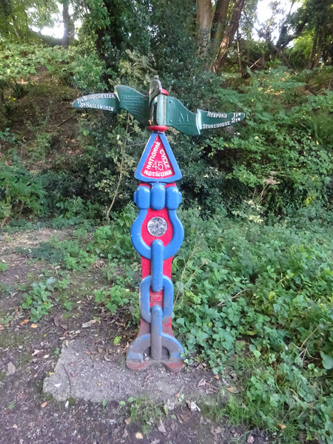
Image: © Mr Red Taken: 17 Sep 2020
On the old Midland Rail line where the original line diverted to Stroud or to Nailsworth. Route 45. There are earlier images despite the differences in OSGR. see https://www.geograph.org.uk/photo/1409723 & https://www.geograph.org.uk/photo/6230170 Millennium Time Trail ID: MP691 see http://umap.openstreetmap.fr/en/map/sustrans-mileposts_71773#15/51.7372/-2.2371
Images are licensed for reuse under creativecommons.org/licenses/by-sa/2.0
Image Location


Leaflet Map data © OpenStreetMap
Latitude
51.737702
Longitude
-2.239652