Low Huntwell
Introduction
The photograph on this page of Low Huntwell by Andrew Curtis as part of the Geograph project.
The Geograph project started in 2005 with the aim of publishing, organising and preserving representative images for every square kilometre of Great Britain, Ireland and the Isle of Man.

There are currently over 7.5m images from over 14,400 individuals and you can help contribute to the project by visiting https://www.geograph.org.uk
Low Huntwell
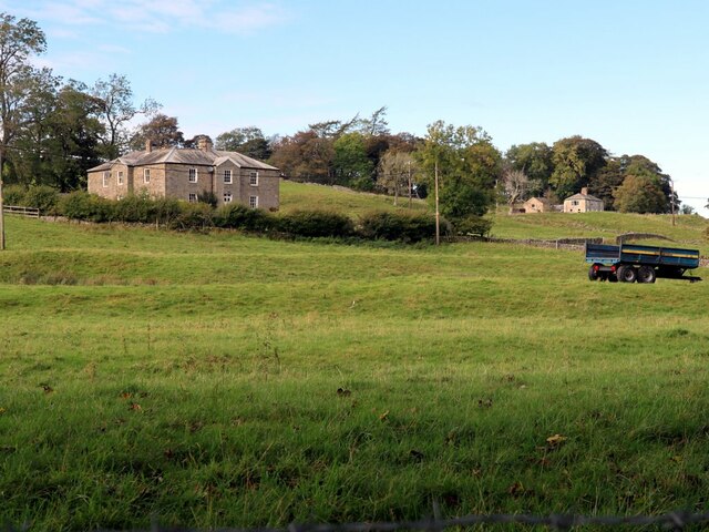
Image: © Andrew Curtis Taken: 6 Oct 2020
Low Huntwell Farmhouse is Grade II Listed (List Entry Number: 1042960): https://historicengland.org.uk/listing/the-list/list-entry/1042960 Huntwell was built for Thomas Sopwith between c.1860 and c.1870. Sopwith was mining agent for W.B. Lead Mines from 1841 to his retirement in 1871. Coating Hill can be seen in the top right corner.
Images are licensed for reuse under creativecommons.org/licenses/by-sa/2.0
Image Location
Latitude
54.824721
Longitude
-2.236082