Widows Row and the former Coastguard Quarters viewed from Newcastle Harbour
Introduction
The photograph on this page of Widows Row and the former Coastguard Quarters viewed from Newcastle Harbour by Eric Jones as part of the Geograph project.
The Geograph project started in 2005 with the aim of publishing, organising and preserving representative images for every square kilometre of Great Britain, Ireland and the Isle of Man.

There are currently over 7.5m images from over 14,400 individuals and you can help contribute to the project by visiting https://www.geograph.org.uk
Widows Row and the former Coastguard Quarters viewed from Newcastle Harbour
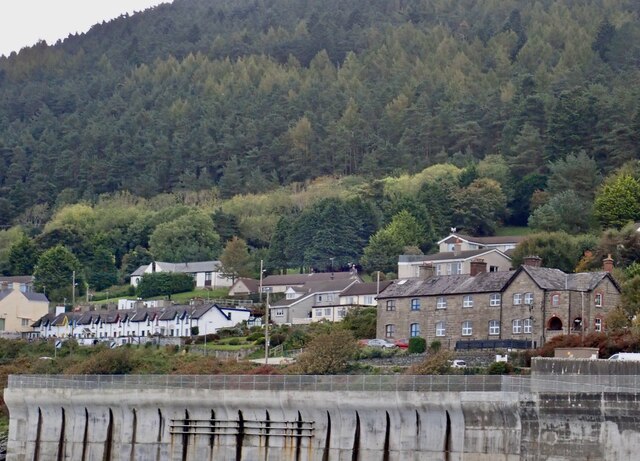
Image: © Eric Jones Taken: 7 Oct 2020
Widows Row was constructed to house the widows of local herring fishermen who were lost in a sudden devastating gale in Dundrum Bay on Friday the 13th of January 1843. The former Coastguard quarters are now divided into apartments.
Images are licensed for reuse under creativecommons.org/licenses/by-sa/2.0
Image Location
Latitude
54.194963
Longitude
-5.883736