Bozomzeal
Introduction
The photograph on this page of Bozomzeal by Derek Harper as part of the Geograph project.
The Geograph project started in 2005 with the aim of publishing, organising and preserving representative images for every square kilometre of Great Britain, Ireland and the Isle of Man.

There are currently over 7.5m images from over 14,400 individuals and you can help contribute to the project by visiting https://www.geograph.org.uk
Bozomzeal
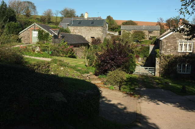
Image: © Derek Harper Taken: 27 Sep 2020
Fourteen years on from Image; there've been some arboreal alterations, and some redecoration. The listed farmhouse is shown on the EH map as the building on the right, but in fact must be the building shown in Image, which is here largely hidden on the left https://historicengland.org.uk/listing/the-list/list-entry/1108283 . Seen from the Dart Valley Trail.
Images are licensed for reuse under creativecommons.org/licenses/by-sa/2.0
Image Location
Latitude
50.371106
Longitude
-3.599766