The Keep, Townstal
Introduction
The photograph on this page of The Keep, Townstal by Derek Harper as part of the Geograph project.
The Geograph project started in 2005 with the aim of publishing, organising and preserving representative images for every square kilometre of Great Britain, Ireland and the Isle of Man.

There are currently over 7.5m images from over 14,400 individuals and you can help contribute to the project by visiting https://www.geograph.org.uk
The Keep, Townstal
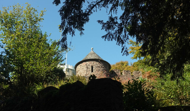
Image: © Derek Harper Taken: 27 Sep 2020
A circular tower with conical tiled roof on a crenellated garden wall, with a glimpse of a drum turret on the house itself https://historicengland.org.uk/listing/the-list/list-entry/1197501 . Seen from the Dart Valley Trail on Townstal Hill.
Images are licensed for reuse under creativecommons.org/licenses/by-sa/2.0
Image Location
Latitude
50.352435
Longitude
-3.583957