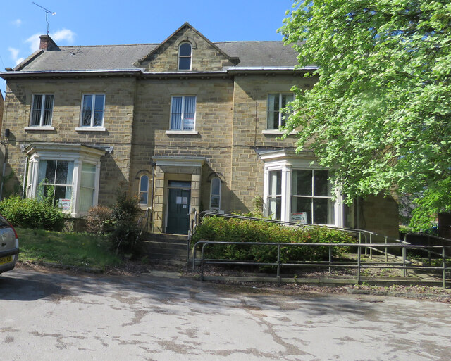
Southgate House 2017
Introduction
The photograph on this page of Southgate House 2017 by Andrew Tatlow as part of the Geograph project.
The Geograph project started in 2005 with the aim of publishing, organising and preserving representative images for every square kilometre of Great Britain, Ireland and the Isle of Man.
There are currently over 7.5m images from over 14,400 individuals and you can help contribute to the project by visiting https://www.geograph.org.uk

Image: © Andrew Tatlow Taken: 5 May 2017
Compare with Image and Image The house was up for auction the week after this picture was taken but it failed to sell. One assumes it has been sold now as when I went past in August 2020 wrought iron gates had been fixed across this entrance. The 2018 Streetview picture shows the house encased in scaffolding and there was also a planning application in 2018 for a change of use to residential and installation of the gates. Another photograph will follow in due course. In 1963 before we sold it to Derbyshire CC the house had over 2 acres of garden but now it only has what we called the Front Drive and the Yard at the rear. The Bottom and Top Lawns now have a Residential Care Home built on them. The Yard had Wash House and a Coal House with The Pond on top. Those building appear to still be there in some shape or form but I doubt there is still a pond! The Coal house had an arched brick roof and then the sides were extended upwards to retain the water of The Pond which sat on the brick arches. It seems a long time since we had one of our regular family and friends parties at Southgate House with 20-30 people there. One time we included fireworks in the Front Drive one October evening; I noticed the local PC standing on Southgate watching the display and when all was finished and we had all gone back inside he came and knocked at the door and told my mother off because it was illegal to set fireworks off that near to the Public Highway; she was not to do it again or else! He said he had enjoyed the show though!

