St Finbar's Church, Fore Street, Fowey
Introduction
The photograph on this page of St Finbar's Church, Fore Street, Fowey by Humphrey Bolton as part of the Geograph project.
The Geograph project started in 2005 with the aim of publishing, organising and preserving representative images for every square kilometre of Great Britain, Ireland and the Isle of Man.

There are currently over 7.5m images from over 14,400 individuals and you can help contribute to the project by visiting https://www.geograph.org.uk
St Finbar's Church, Fore Street, Fowey
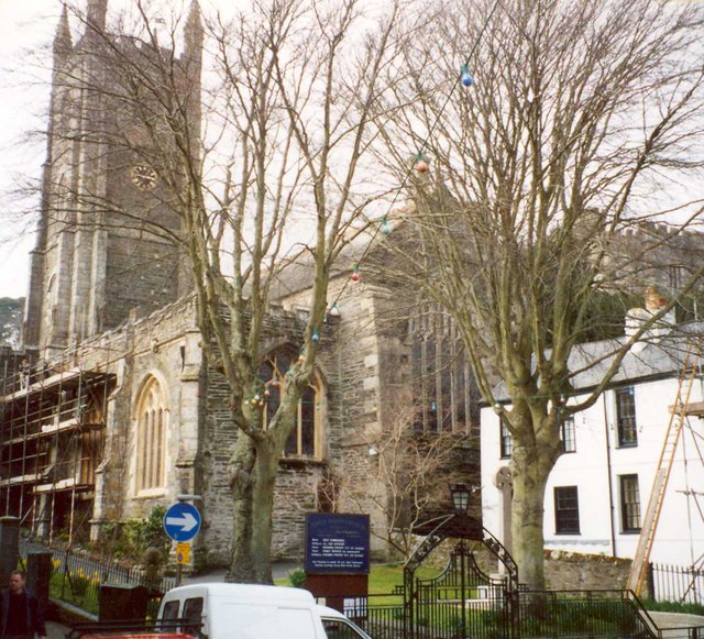
Image: © Humphrey Bolton Taken: 7 Mar 2001
The saint is also known as St Fimbarrus, presumably a Latinised version. The church was built in 1336 to replace the Norman church that had replaced the Celtic one. The church was damaged by the French in 1457, and repaired in 1460 by the Earl of Warwick, when the clerestory and the N & S aisles rebuilt; they are now unusually wide. There is an exceptionally fine 15C carved wagon roof. The high W tower, richly decorated, is 16C. The S porch has open arches to the W and E and an eight-ribbed vaulted roof. Norman font of catacleuse slate. Hexagonal pulpit of 1601. Monuments to the Rashleighs. The church was used as a town hall for a period up to 1684.
Images are licensed for reuse under creativecommons.org/licenses/by-sa/2.0
Image Location


Leaflet Map data © OpenStreetMap
Latitude
50.335313
Longitude
-4.63608