Northeast on Emscote Road, Warwick, at the Pickard Street junction
Introduction
The photograph on this page of Northeast on Emscote Road, Warwick, at the Pickard Street junction by Robin Stott as part of the Geograph project.
The Geograph project started in 2005 with the aim of publishing, organising and preserving representative images for every square kilometre of Great Britain, Ireland and the Isle of Man.

There are currently over 7.5m images from over 14,400 individuals and you can help contribute to the project by visiting https://www.geograph.org.uk
Northeast on Emscote Road, Warwick, at the Pickard Street junction
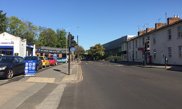
Image: © Robin Stott Taken: 9 Sep 2020
This photo is a recreation of the first Geograph for the square Image by David Stowell in April 2005. It is a wider, and a wider-angle view than David's but the viewpoint is the same. What I notice is the difference in eye-level: David is tall and I'm getting shorter. Protyre, left, was photographed by Ian Rob in 2012. The branch of Halfords beyond it might have been Nationwide car servicing in 2005. The closed Homebase DIY store (Focus in 2005), right of centre, awaits redevelopment. A planning application by Lidl has been refused. In Warwick, Emscote Road continues to be the busy main link with neighbouring Royal Leamington Spa.
Images are licensed for reuse under creativecommons.org/licenses/by-sa/2.0
Image Location


Leaflet Map data © OpenStreetMap
Latitude
52.285785
Longitude
-1.572479