Milestone A38, Eastington turn
Introduction
The photograph on this page of Milestone A38, Eastington turn by Mr Red as part of the Geograph project.
The Geograph project started in 2005 with the aim of publishing, organising and preserving representative images for every square kilometre of Great Britain, Ireland and the Isle of Man.

There are currently over 7.5m images from over 14,400 individuals and you can help contribute to the project by visiting https://www.geograph.org.uk
Milestone A38, Eastington turn
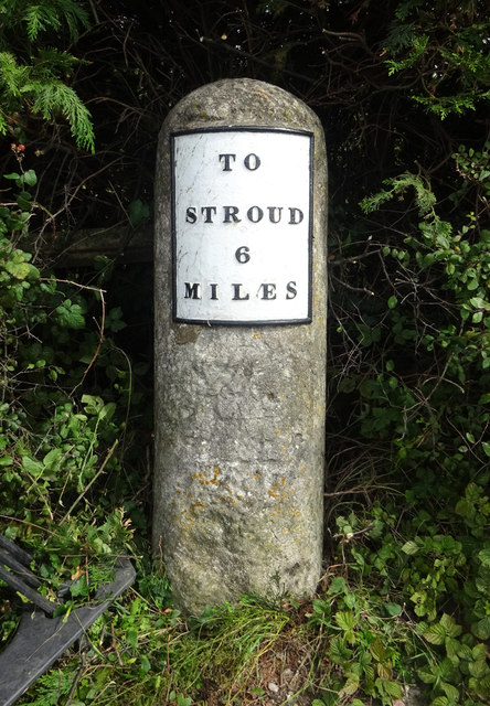
Image: © Mr Red Taken: 4 Sep 2020
Metal plate attached to stone post by the A38, in parish of EASTINGTON (STROUD District), Claypits; opp. garage, NE corner jcn , by traffic lights, on North side of road. Stroud iron plate erected by the Cainscross (Division) turnpike trust in the 19th century. Alternative image - https://www.geograph.org.uk/photo/6048599 More milestones in the area see http://umap.openstreetmap.fr/en/map/stonehouse-milestones_519080#14/51.7521/-2.2960 Inscription reads:- : TO / STROUD / 6 / MILES Listed. Milestone Society National ID: GL_SDGL06
Images are licensed for reuse under creativecommons.org/licenses/by-sa/2.0
Image Location
Latitude
51.753092
Longitude
-2.342415