Main Street, Strelley
Introduction
The photograph on this page of Main Street, Strelley by Kate Jewell as part of the Geograph project.
The Geograph project started in 2005 with the aim of publishing, organising and preserving representative images for every square kilometre of Great Britain, Ireland and the Isle of Man.

There are currently over 7.5m images from over 14,400 individuals and you can help contribute to the project by visiting https://www.geograph.org.uk
Main Street, Strelley
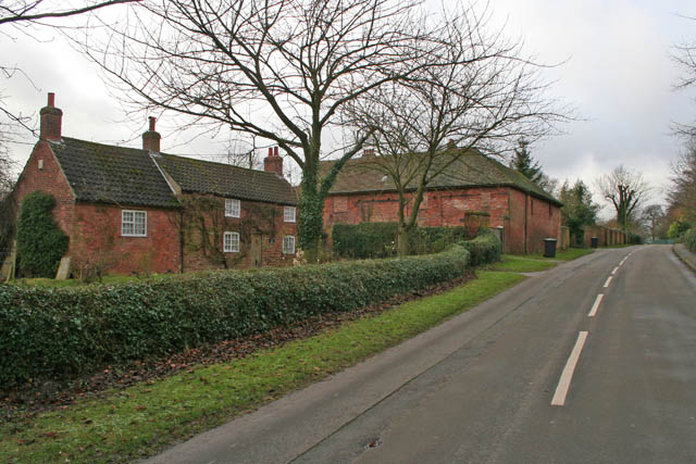
Image: © Kate Jewell Taken: 14 Jan 2008
Grange Cottage in the foreground and the old barns just east of Golder Close House beyond. Grange Cottage is an 18th Century brick cottage with original Yorkshire sliding sash windows, (these slide sideways), and central doorway to its front elevation. The side extension in matching materials built around 1840 and was used as an infant school until 1872 when a purpose built school was erected on Main Street near the junction with Bilborough Road.
Images are licensed for reuse under creativecommons.org/licenses/by-sa/2.0
Image Location
Latitude
52.971402
Longitude
-1.24113