Grade II Listed Pit House near Llanarth, Monmouthshire
Introduction
The photograph on this page of Grade II Listed Pit House near Llanarth, Monmouthshire by Jaggery as part of the Geograph project.
The Geograph project started in 2005 with the aim of publishing, organising and preserving representative images for every square kilometre of Great Britain, Ireland and the Isle of Man.

There are currently over 7.5m images from over 14,400 individuals and you can help contribute to the project by visiting https://www.geograph.org.uk
Grade II Listed Pit House near Llanarth, Monmouthshire
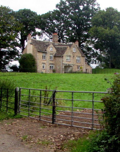
Image: © Jaggery Taken: 6 Sep 2020
Cadw records that this is a 17th century gentry house, possibly with earlier origins. Formerly part of the Llanarth estate, it was the house for the Roman Catholic priest in charge of the church at Llanarth Court. Shown on the 1843 tithe map as the Great Pit House occupied by the Rev. Samuel Fisher.
Images are licensed for reuse under creativecommons.org/licenses/by-sa/2.0
Image Location
Latitude
51.785729
Longitude
-2.914287