The former site of Knowetop Community Farm
Introduction
The photograph on this page of The former site of Knowetop Community Farm by Lairich Rig as part of the Geograph project.
The Geograph project started in 2005 with the aim of publishing, organising and preserving representative images for every square kilometre of Great Britain, Ireland and the Isle of Man.

There are currently over 7.5m images from over 14,400 individuals and you can help contribute to the project by visiting https://www.geograph.org.uk
The former site of Knowetop Community Farm
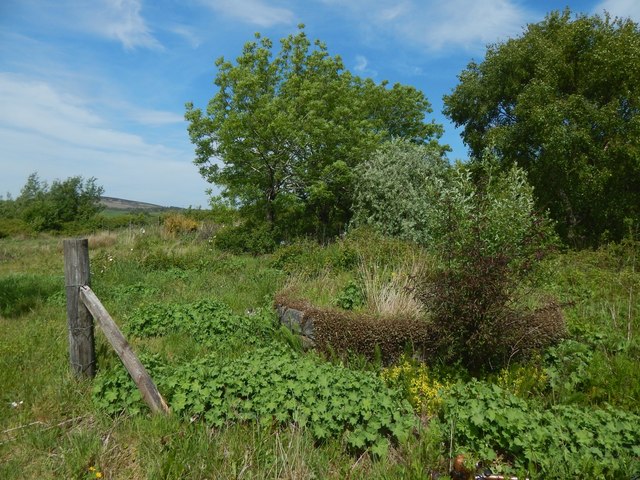
Image: © Lairich Rig Taken: 29 May 2020
The round feature being swallowed up by the vegetation was shaped like a wishing well and had a wooden canopy; there was a stone head beside it.
Images are licensed for reuse under creativecommons.org/licenses/by-sa/2.0
Image Location
Latitude
55.951702
Longitude
-4.591925