The red line marks the problem
Introduction
The photograph on this page of The red line marks the problem by Neil Owen as part of the Geograph project.
The Geograph project started in 2005 with the aim of publishing, organising and preserving representative images for every square kilometre of Great Britain, Ireland and the Isle of Man.

There are currently over 7.5m images from over 14,400 individuals and you can help contribute to the project by visiting https://www.geograph.org.uk
The red line marks the problem
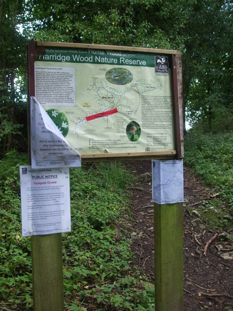
Image: © Neil Owen Taken: 20 Aug 2020
Harridge Woods are a nature reserve that has a number of paths through it. However, the application of some red tape on the map shows that part of the woods are out of bounds. The area has been hit badly by Ash Dieback (Hymenoscyphus fraxineus fungus) and some trees are unstable now.
Images are licensed for reuse under creativecommons.org/licenses/by-sa/2.0
Image Location
Latitude
51.227105
Longitude
-2.510488