Ashley Hill Junction Signalbox
Introduction
The photograph on this page of Ashley Hill Junction Signalbox by Martin Tester as part of the Geograph project.
The Geograph project started in 2005 with the aim of publishing, organising and preserving representative images for every square kilometre of Great Britain, Ireland and the Isle of Man.

There are currently over 7.5m images from over 14,400 individuals and you can help contribute to the project by visiting https://www.geograph.org.uk
Ashley Hill Junction Signalbox
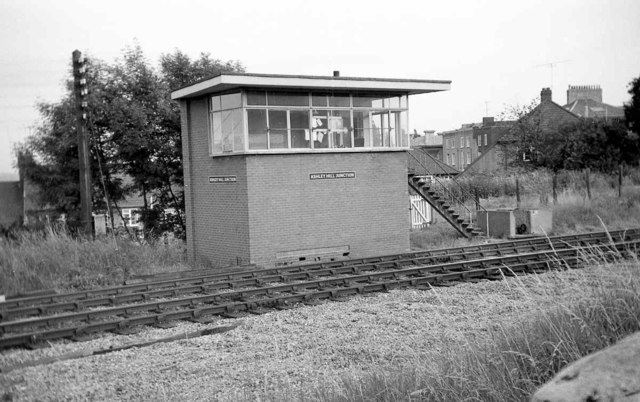
Image: © Martin Tester Taken: 16 Jul 1966
Less than ½ mile east of Montpelier Station the line heading into Bristol split at Ashley Hill Junction. The left hand route, owned by the Midland Rly (later LMSR), carried straight on to Kingswood Junction (near Fishponds) on the MR's line from Temple Meads to Gloucester & the Midlands. The right hand route curved round to Narroways Hill Junction on the GWR's line from Temple Meads to Filton & South Wales. The junction was controlled by this modern signalbox which came into use in May 1959 replacing a much older box. It had a very short life, being taken out of use in February 1966, 5 months before the photo. The reason for its demise was the closure (in June 1965) of the line to Kingswood Junction, thus making it redundant. The track had already been removed here but its path can be made out from the empty ground at the bottom of the photo.
Images are licensed for reuse under creativecommons.org/licenses/by-sa/2.0
Image Location
Latitude
51.471904
Longitude
-2.578725