St. Leonards from the churchyard
Introduction
The photograph on this page of St. Leonards from the churchyard by Rob Farrow as part of the Geograph project.
The Geograph project started in 2005 with the aim of publishing, organising and preserving representative images for every square kilometre of Great Britain, Ireland and the Isle of Man.

There are currently over 7.5m images from over 14,400 individuals and you can help contribute to the project by visiting https://www.geograph.org.uk
St. Leonards from the churchyard
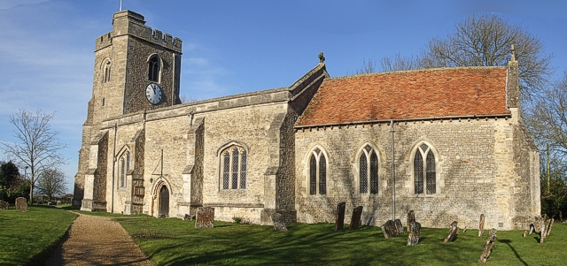
Image: © Rob Farrow Taken: 12 Jan 2008
This is a stitched panorama shot of St. Leonards which can be detected by the slight bowing effect on the building. An unmanipulated view of the church can be seen in Image], but I've included this photo as it shows the entire length of the church without any obstructions.
Images are licensed for reuse under creativecommons.org/licenses/by-sa/2.0
Image Location
Latitude
51.883278
Longitude
-1.017535