Wardlaw Hill trig point
Introduction
The photograph on this page of Wardlaw Hill trig point by Mary and Angus Hogg as part of the Geograph project.
The Geograph project started in 2005 with the aim of publishing, organising and preserving representative images for every square kilometre of Great Britain, Ireland and the Isle of Man.

There are currently over 7.5m images from over 14,400 individuals and you can help contribute to the project by visiting https://www.geograph.org.uk
Wardlaw Hill trig point
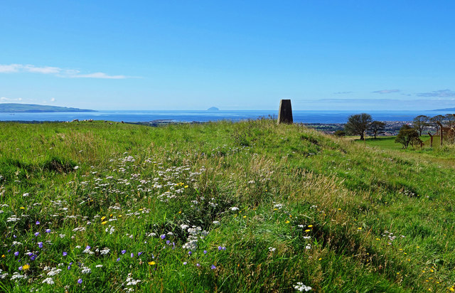
Image: © Mary and Angus Hogg Taken: 24 Aug 2020
The trig point lies on the northern edge of Wardlaw Hill Fort. Remains of a defence wall can still be seen around this small structure with a separate tiny mound on the northern point. The mapping surveyors as well as the original inhabitants recognised the value of this site as a viewpoint. The origin of the fort is uncertain but the 1857 OS Name Book ascribes it to the Roman period although no one is really sure. Other sources suggest prehistoric origins. The Old Statistical Account considered possible occupation of the site by the Vikings before the Battle of Largs.
Images are licensed for reuse under creativecommons.org/licenses/by-sa/2.0
Image Location
Latitude
55.56092
Longitude
-4.603073