Plaque, Newtown Chapel, Paulton
Introduction
The photograph on this page of Plaque, Newtown Chapel, Paulton by Derek Harper as part of the Geograph project.
The Geograph project started in 2005 with the aim of publishing, organising and preserving representative images for every square kilometre of Great Britain, Ireland and the Isle of Man.

There are currently over 7.5m images from over 14,400 individuals and you can help contribute to the project by visiting https://www.geograph.org.uk
Plaque, Newtown Chapel, Paulton
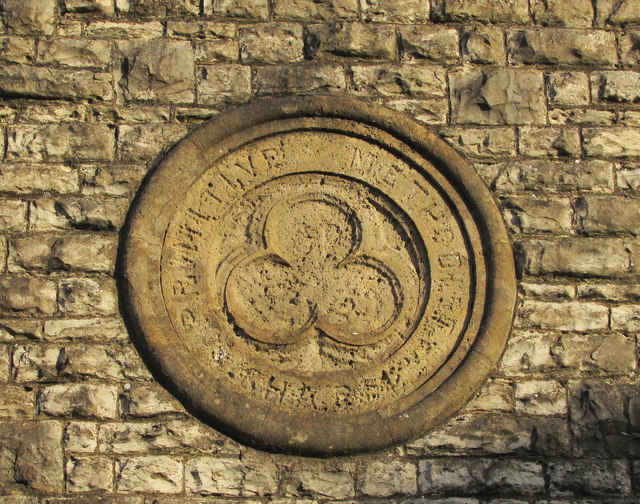
Image: © Derek Harper Taken: 9 Dec 2019
The trefoil-centred plaque is on the gable end of the chapel shown in Image The words "Primitive Methodist" are clear enough, but the other word is badly eroded: "HA R" is discernable.
Images are licensed for reuse under creativecommons.org/licenses/by-sa/2.0
Image Location


Leaflet Map data © OpenStreetMap
Latitude
51.304814
Longitude
-2.506042