Park Lane
Introduction
The photograph on this page of Park Lane by Andy Waddington as part of the Geograph project.
The Geograph project started in 2005 with the aim of publishing, organising and preserving representative images for every square kilometre of Great Britain, Ireland and the Isle of Man.

There are currently over 7.5m images from over 14,400 individuals and you can help contribute to the project by visiting https://www.geograph.org.uk
Park Lane
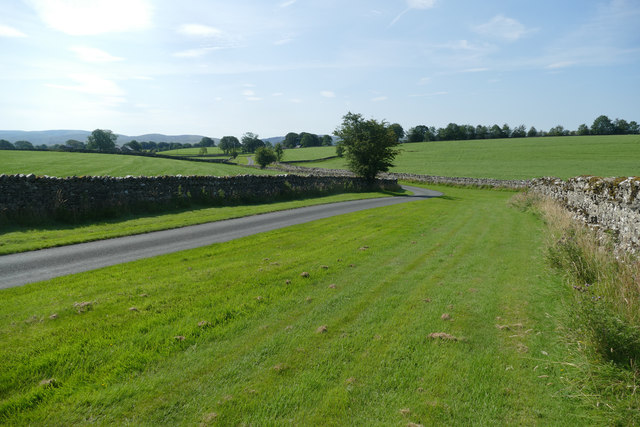
Image: © Andy Waddington Taken: 15 Aug 2020
Park Lane is a very neatly manicured road for a farm track, leading form the B road in the distance to Park, a group of farm buildings. The view is from just north of the bend where the public footpath from Bousfield joins the road, and you can just make out the sign for the public footpath going to the village of Orton at the next bend. Behind the photographer, the road continues as a right of way for pedestrians to turn east at the farm, heading for Dawns and Bullflatt via a somewhat unnerving encounter with cows (having a nervous young collie with us did not help one bit).
Images are licensed for reuse under creativecommons.org/licenses/by-sa/2.0
Image Location
Latitude
54.472703
Longitude
-2.601452