West Street Ilminster, OS Flush Bracket Benchmark
Introduction
The photograph on this page of West Street Ilminster, OS Flush Bracket Benchmark by Meg Hepworth as part of the Geograph project.
The Geograph project started in 2005 with the aim of publishing, organising and preserving representative images for every square kilometre of Great Britain, Ireland and the Isle of Man.

There are currently over 7.5m images from over 14,400 individuals and you can help contribute to the project by visiting https://www.geograph.org.uk
West Street Ilminster, OS Flush Bracket Benchmark
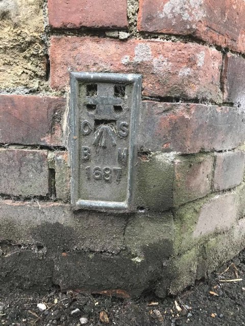
Image: © Meg Hepworth Taken: 15 Aug 2020
This is a flush bracket benchmark, 0.3m above the ground and 53.14m above Ordnance Datum Newlyn (Tide Gauge Bolt Newlyn Pier - the authoritative datum for the UK). It was last verified in 1952. Grid ref: ST 3584 1471. Description: FL BR 1687 BLDG NO31 WEST ST N FACE 1.5M E PRODN. www.geograph.org.uk/photo/6570302
Images are licensed for reuse under creativecommons.org/licenses/by-sa/2.0
Image Location
Latitude
50.928258
Longitude
-2.914302