Old Milepost by the A6, north of Shap
Introduction
The photograph on this page of Old Milepost by the A6, north of Shap by Terry Moore as part of the Geograph project.
The Geograph project started in 2005 with the aim of publishing, organising and preserving representative images for every square kilometre of Great Britain, Ireland and the Isle of Man.

There are currently over 7.5m images from over 14,400 individuals and you can help contribute to the project by visiting https://www.geograph.org.uk
Old Milepost by the A6, north of Shap
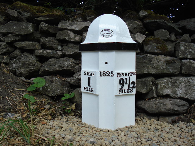
Image: © Terry Moore Taken: 15 Jul 2018
Cast iron post by the A6, in parish of SHAP (EDEN District), North of Shap, 350m South of junction to Sleagill; 60m South of lay-by, by the road, on East side of road. Winder iron casting, erected by the Heronsyke & Eamont Bridge turnpike trust in the 19th century. Inscription reads:- : SHAP / 1 / MILE : : 1825 : : PENRITH / 9½ / MILES : : T.Winder / Gatebeck / Foundry : Restored and set upright July 2018. Listed. Milestone Society National ID: WE_SPPR01.
Images are licensed for reuse under creativecommons.org/licenses/by-sa/2.0
Image Location
Latitude
54.539868
Longitude
-2.680339