Wing wall, Pea Road Railway Bridge
Introduction
The photograph on this page of Wing wall, Pea Road Railway Bridge by Adrian Taylor as part of the Geograph project.
The Geograph project started in 2005 with the aim of publishing, organising and preserving representative images for every square kilometre of Great Britain, Ireland and the Isle of Man.

There are currently over 7.5m images from over 14,400 individuals and you can help contribute to the project by visiting https://www.geograph.org.uk
Wing wall, Pea Road Railway Bridge
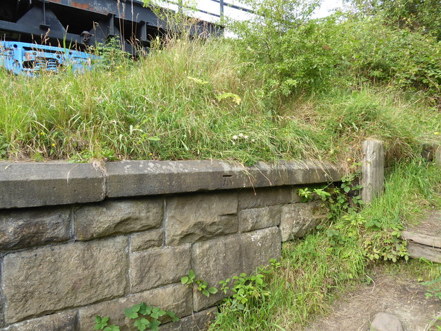
Image: © Adrian Taylor Taken: 10 Aug 2020
Detail of the stone built wing wall of Pea Road Railway Bridge. In front of the wall is a path leading up onto the Consett and Sunderland Railway Path. The metal bridge deck is supported upon two halves of a British Rail container flat wagon complete with bogies and wheels, part of which can be seen. There is a cut benchmark symbol on the coping stone of the wall (photograph Image).
Images are licensed for reuse under creativecommons.org/licenses/by-sa/2.0
Image Location
Latitude
54.869178
Longitude
-1.709996