Old Boundary Marker
Introduction
The photograph on this page of Old Boundary Marker by C Brash as part of the Geograph project.
The Geograph project started in 2005 with the aim of publishing, organising and preserving representative images for every square kilometre of Great Britain, Ireland and the Isle of Man.

There are currently over 7.5m images from over 14,400 individuals and you can help contribute to the project by visiting https://www.geograph.org.uk
Old Boundary Marker
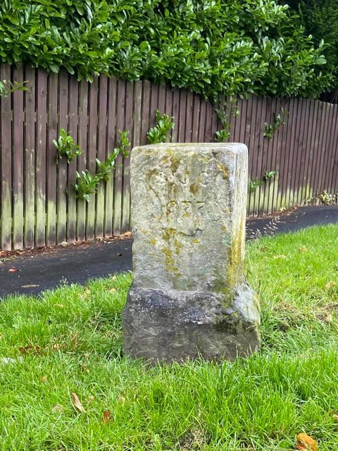
Image: © C Brash Taken: 30 Jun 2020
Parish Boundary Marker on the southwest side of the junction of Mickley Lane and Baslow Road, Sheffield. Inscribed A St J C / 1877 (Abbeydale St John Consolidated Chapelry). This stone originally said "A St J C C / 1877" with a number. This stands for Abbeydale St John Consolidated Chapelry. This appears to be No 2: there were six of them originally, and it would be interesting to know if any others have survived or been swallowed up in later housing developments. Full details of the boundary and locations of the others are in the London Gazette of 25 January 1878, pages 391-392. See https://www.thegazette.co.uk/London/issue/24546/page/391. Information from Richard Heywood. See also https://www.geograph.org.uk/photo/6110723. Milestone Society National ID: YW_SHStJ01pb
Images are licensed for reuse under creativecommons.org/licenses/by-sa/2.0
Image Location
Latitude
53.315726
Longitude
-1.531959