An intact top
Introduction
The photograph on this page of An intact top by Neil Owen as part of the Geograph project.
The Geograph project started in 2005 with the aim of publishing, organising and preserving representative images for every square kilometre of Great Britain, Ireland and the Isle of Man.

There are currently over 7.5m images from over 14,400 individuals and you can help contribute to the project by visiting https://www.geograph.org.uk
An intact top
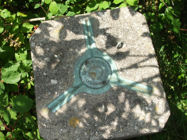
Image: © Neil Owen Taken: 30 Jul 2020
This triangulation pillar is really close to a large population yet it seems pretty untouched - unlike many in similar places. The top of the pillar shows the spider for the theodolite and the centre cap is original - most are now lost or filled in. The three hooks were to aid installation. See Image] for the flush bracket.
Images are licensed for reuse under creativecommons.org/licenses/by-sa/2.0
Image Location
Latitude
51.446511
Longitude
-2.529336