The discovery of a private Bournemouth WWII air raid shelter (1)
Introduction
The photograph on this page of The discovery of a private Bournemouth WWII air raid shelter (1) by Mike Searle as part of the Geograph project.
The Geograph project started in 2005 with the aim of publishing, organising and preserving representative images for every square kilometre of Great Britain, Ireland and the Isle of Man.

There are currently over 7.5m images from over 14,400 individuals and you can help contribute to the project by visiting https://www.geograph.org.uk
The discovery of a private Bournemouth WWII air raid shelter (1)
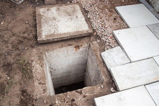
Image: © Mike Searle Taken: 28 Jul 2020
It is becoming fairly obvious that a number of the wealthier Bournemouth families perhaps in anticipation of impending hostilities had their own private air raid shelters constructed in their gardens before the outbreak of WWII. Yesterday I was privileged to have been invited by a landscape gardener working at a property at Ravine Road in Southbourne who had uncovered purely by chance, a buried structure that was previously unknown to the present homeowner. The entrance passage to it appears to have been blocked with rubble and sealed, but access was discovered via the escape hatch chamber that was uncovered during work on the patio. From there one enters a large cube shaped room about 3m x 3m x 3m that was fitted with lighting, and a 2 pin electrical socket. It is evident it was in use postwar as a store with signs of former wooden shelving on the walls. There are large metal hooks in the ceiling that may have been associated with sleeping, possibly to sling hammocks? Image
Images are licensed for reuse under creativecommons.org/licenses/by-sa/2.0
Image Location
Latitude
50.724788
Longitude
-1.823085