Old Boundary Marker
Introduction
The photograph on this page of Old Boundary Marker by B Westlake as part of the Geograph project.
The Geograph project started in 2005 with the aim of publishing, organising and preserving representative images for every square kilometre of Great Britain, Ireland and the Isle of Man.

There are currently over 7.5m images from over 14,400 individuals and you can help contribute to the project by visiting https://www.geograph.org.uk
Old Boundary Marker
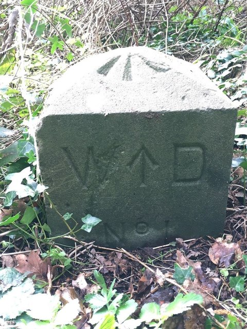
Image: © B Westlake Taken: 19 Mar 2020
War Department Boundary Marker on the southwest side of Woodlands Road. Portishead parish. Inscribed W ↑ D / No 1. See also https://www.geograph.org.uk/photo/4867279. Milestone Society National ID: SO_WDPORT01em
Images are licensed for reuse under creativecommons.org/licenses/by-sa/2.0
Image Location
Latitude
51.493478
Longitude
-2.767695