Old Boundary Marker
Introduction
The photograph on this page of Old Boundary Marker by R Rothwell as part of the Geograph project.
The Geograph project started in 2005 with the aim of publishing, organising and preserving representative images for every square kilometre of Great Britain, Ireland and the Isle of Man.

There are currently over 7.5m images from over 14,400 individuals and you can help contribute to the project by visiting https://www.geograph.org.uk
Old Boundary Marker
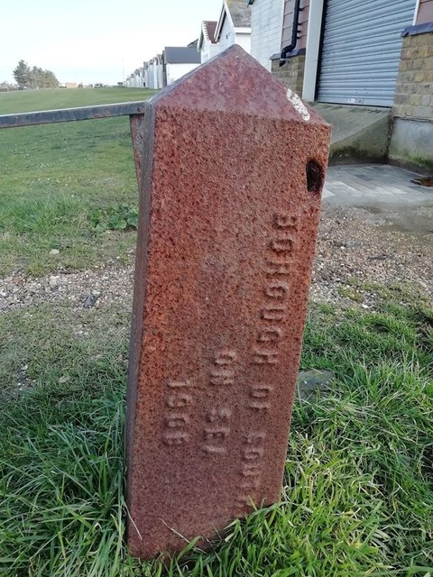
Image: © R Rothwell Taken: 10 Apr 2020
Municipal Boundary Marker in front of beach huts between the road and the beach opposite junction of Maplin Way and Shoebury Common Road. Now entirely in the boundary of Southend on Sea unitary authority. In raised lettering BOROUGH OF SOUTHEND / ON SEA / 1908 and URBAN DISTRICT / OF SHOEBURYNESS. Milestone Society National ID: EX_SOUS07pb
Images are licensed for reuse under creativecommons.org/licenses/by-sa/2.0
Image Location
Latitude
51.527906
Longitude
0.769102