Hugh Lupus Street
Introduction
The photograph on this page of Hugh Lupus Street by philandju as part of the Geograph project.
The Geograph project started in 2005 with the aim of publishing, organising and preserving representative images for every square kilometre of Great Britain, Ireland and the Isle of Man.

There are currently over 7.5m images from over 14,400 individuals and you can help contribute to the project by visiting https://www.geograph.org.uk
Hugh Lupus Street
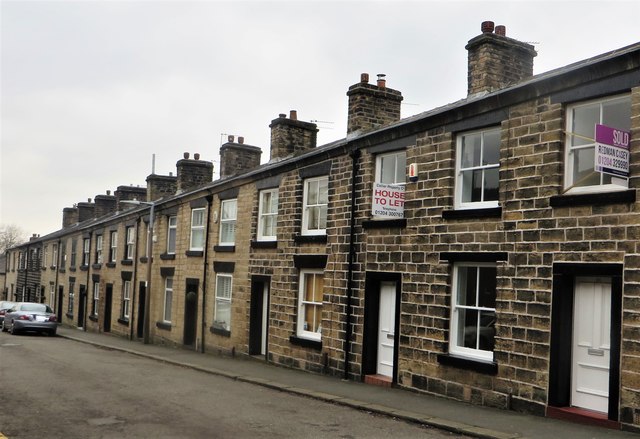
Image: © philandju Taken: 13 Jan 2018
The houses are in Bank Top, a model village built circa 1835 by cotton mill owners the Ashworth family., to house their workers. It is likely that the street is named after Hugh Lupus Grosvenor, 1st. Duke of Westminster, with whom the Ashworths had some business dealings. The houses are Grade 2 listed.
Images are licensed for reuse under creativecommons.org/licenses/by-sa/2.0
Image Location
Latitude
53.605972
Longitude
-2.422669