Hen Neuadd
Introduction
The photograph on this page of Hen Neuadd by Alan Richards as part of the Geograph project.
The Geograph project started in 2005 with the aim of publishing, organising and preserving representative images for every square kilometre of Great Britain, Ireland and the Isle of Man.

There are currently over 7.5m images from over 14,400 individuals and you can help contribute to the project by visiting https://www.geograph.org.uk
Hen Neuadd
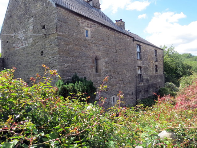
Image: © Alan Richards Taken: 20 Jul 2020
Adeiladwyd y ty cyntaf yn ystod y 15g ac fe'i hailgodwyd yn bennaf yn ystod y 17g. Gweddnewidiwyd yr anhedd-dy yn y 19g ac fe'i hadnewidiwyd yn 1986. With early C15 origins the house was largely rebuilt during the 17th century. Altered during the 19th century the property was restored in 1986.
Images are licensed for reuse under creativecommons.org/licenses/by-sa/2.0
Image Location
Latitude
51.799815
Longitude
-3.719602