Looking down from the Windegg Scar bridleway
Introduction
The photograph on this page of Looking down from the Windegg Scar bridleway by Andy Waddington as part of the Geograph project.
The Geograph project started in 2005 with the aim of publishing, organising and preserving representative images for every square kilometre of Great Britain, Ireland and the Isle of Man.

There are currently over 7.5m images from over 14,400 individuals and you can help contribute to the project by visiting https://www.geograph.org.uk
Looking down from the Windegg Scar bridleway
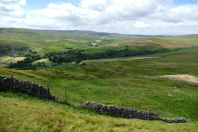
Image: © Andy Waddington Taken: 19 Jul 2020
The bridleway follows a good Landrover track just below Windegg Scar, and as the Valley of Shaw Beck drops away into Arkengarthdale, excellent views up the dale open up. The expanse of bare stones on the right of the photo is a mine waste tip from nineteenth century lead working on the Freemans Vein above. The woodland beyond Stang Lane is Eskeleth Wood, which shows promise of being bigger in the future as there is quite a lot of new planting in tree shelters in the valley upstream. On the far horizon are Rogans Seat and Water Crag, within a few metres of the same height on Gunnerside and Arkengarthdale Moors.
Images are licensed for reuse under creativecommons.org/licenses/by-sa/2.0
Image Location
Latitude
54.429985
Longitude
-1.993338