Direction Sign ? Signpost in Maer
Introduction
The photograph on this page of Direction Sign ? Signpost in Maer by D Phillips as part of the Geograph project.
The Geograph project started in 2005 with the aim of publishing, organising and preserving representative images for every square kilometre of Great Britain, Ireland and the Isle of Man.

There are currently over 7.5m images from over 14,400 individuals and you can help contribute to the project by visiting https://www.geograph.org.uk
Direction Sign ? Signpost in Maer
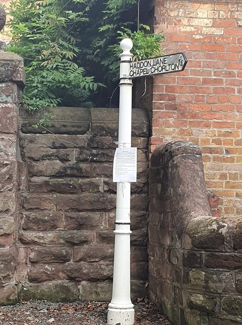
Image: © D Phillips Taken: 1 Aug 2019
Located on the west side of the junction of Clayalders Bank and Haddon Lane in Maer parish. 1 arm and ball finial. Milestone Society National ID: ST_SJ7938
Images are licensed for reuse under creativecommons.org/licenses/by-sa/2.0
Image Location
Latitude
52.941019
Longitude
-2.310715