
Junction of Rowhope and Trows Burn Near Rowhope
Introduction
The photograph on this page of Junction of Rowhope and Trows Burn Near Rowhope by Geoff Holland as part of the Geograph project.
The Geograph project started in 2005 with the aim of publishing, organising and preserving representative images for every square kilometre of Great Britain, Ireland and the Isle of Man.

There are currently over 7.5m images from over 14,400 individuals and you can help contribute to the project by visiting https://www.geograph.org.uk
Junction of Rowhope and Trows Burn Near Rowhope
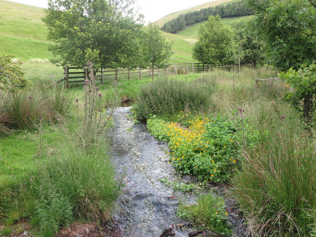
Image: © Geoff Holland Taken: 14 Jul 2020
At this point the Trows Burn (right) merges with the Rowhope Burn (ahead) which then continues to join the River Coquet at Slymefoot, 1.3 kilometres downstream. As well as the burn being edged with Mimulus, it also contained a large quantity of Water Crowfoot, the small white flowers seen here floating on the surface of the burn. Water crowfoots are aquatic plants related to buttercups that are native to the UK and are recognisable by their small, seasonal white flowers. Water crowfoots thrive best in unpolluted, moving water courses, such as streams and rivers and their presence has long been used as a natural indicator of clean water. There are several closely related species which are sometimes hard to tell apart. For a selection of detailed free to download walking routes in the area visit www.cheviotwalks.co.uk
Images are licensed for reuse under creativecommons.org/licenses/by-sa/2.0
Image Location

Latitude
55.402618
Longitude
-2.23257