Teaching Sailing at Grassy Beach
Introduction
The photograph on this page of Teaching Sailing at Grassy Beach by Ian Paterson as part of the Geograph project.
The Geograph project started in 2005 with the aim of publishing, organising and preserving representative images for every square kilometre of Great Britain, Ireland and the Isle of Man.

There are currently over 7.5m images from over 14,400 individuals and you can help contribute to the project by visiting https://www.geograph.org.uk
Teaching Sailing at Grassy Beach
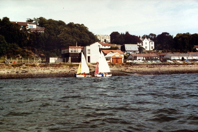
Image: © Ian Paterson Taken: Unknown
View from the safety boat of the Wayfarer dinghies used for teaching sailing to Royal Yachting Association standards at Tayside Regional Council's Outdoor Education base at Grassy Beach. This photo would have been taken in the mid 1980's. Sailing took place two days a week and at weekends.
Images are licensed for reuse under creativecommons.org/licenses/by-sa/2.0
Image Location
Latitude
56.468363
Longitude
-2.897072