The Nags Head, Clowne
Introduction
The photograph on this page of The Nags Head, Clowne by al partington as part of the Geograph project.
The Geograph project started in 2005 with the aim of publishing, organising and preserving representative images for every square kilometre of Great Britain, Ireland and the Isle of Man.

There are currently over 7.5m images from over 14,400 individuals and you can help contribute to the project by visiting https://www.geograph.org.uk
The Nags Head, Clowne
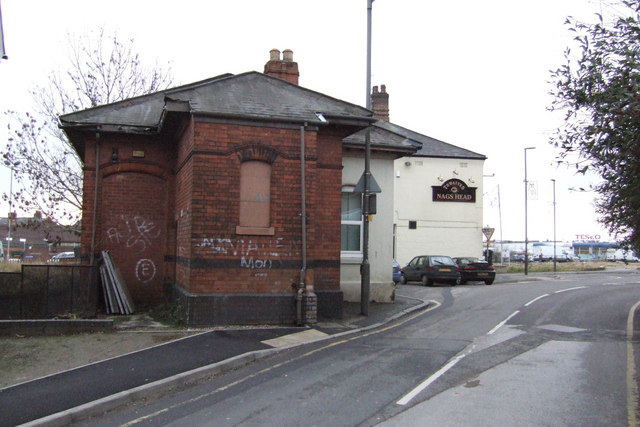
Image: © al partington Taken: 2 Jan 2008
An outpost of the Lancashire brewer, Thwaites lies behind the booking hall of the former Great Central Railway's station closed in 1939 - albeit the Flying Scotsman did go underneath it in 1963.
Images are licensed for reuse under creativecommons.org/licenses/by-sa/2.0
Image Location
Latitude
53.276181
Longitude
-1.262589