Level Crossing, George Street to Ings Road, Snaith
Introduction
The photograph on this page of Level Crossing, George Street to Ings Road, Snaith by Chris Morgan as part of the Geograph project.
The Geograph project started in 2005 with the aim of publishing, organising and preserving representative images for every square kilometre of Great Britain, Ireland and the Isle of Man.

There are currently over 7.5m images from over 14,400 individuals and you can help contribute to the project by visiting https://www.geograph.org.uk
Level Crossing, George Street to Ings Road, Snaith
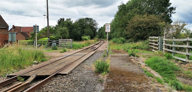
Image: © Chris Morgan Taken: 6 Jul 2020
Evidence of long abandoned second track still to be seen on the right, the old rails left intact.
Images are licensed for reuse under creativecommons.org/licenses/by-sa/2.0
Image Location
Latitude
53.693437
Longitude
-1.024212