Edington houses [16]
Introduction
The photograph on this page of Edington houses [16] by Michael Dibb as part of the Geograph project.
The Geograph project started in 2005 with the aim of publishing, organising and preserving representative images for every square kilometre of Great Britain, Ireland and the Isle of Man.

There are currently over 7.5m images from over 14,400 individuals and you can help contribute to the project by visiting https://www.geograph.org.uk
Edington houses [16]
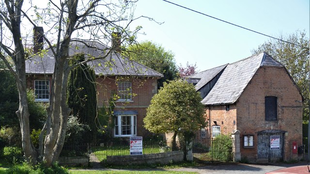
Image: © Michael Dibb Taken: 24 Apr 2020
Funtington House was built circa 1840 in brick. The stables alongside are 18th century and were rebuilt in the 19th century and were possibly the stables for The George coaching inn adjacent (see Image). The house and attached railings and gates are listed, grade II, with details at: https://historicengland.org.uk/listing/the-list/list-entry/1181371 The stables are listed, grade II, with details at: https://historicengland.org.uk/listing/the-list/list-entry/1021498 Edington is a former agricultural village which lies on the ‘springline’ of the northern escarpment of Salisbury Plain about 4 miles east of the town of Westbury. A priory was founded in the 14th century and became a monastery of the Brothers of Penitence, or Bonshommes. The magnificent monastery church continues in use as the parish church and is the home of the nationally-known annual Edington Music Festival.
Images are licensed for reuse under creativecommons.org/licenses/by-sa/2.0
Image Location
Latitude
51.27997
Longitude
-2.099021