Almscliffe Manor, North Rigton
Introduction
The photograph on this page of Almscliffe Manor, North Rigton by Stephen Craven as part of the Geograph project.
The Geograph project started in 2005 with the aim of publishing, organising and preserving representative images for every square kilometre of Great Britain, Ireland and the Isle of Man.

There are currently over 7.5m images from over 14,400 individuals and you can help contribute to the project by visiting https://www.geograph.org.uk
Almscliffe Manor, North Rigton
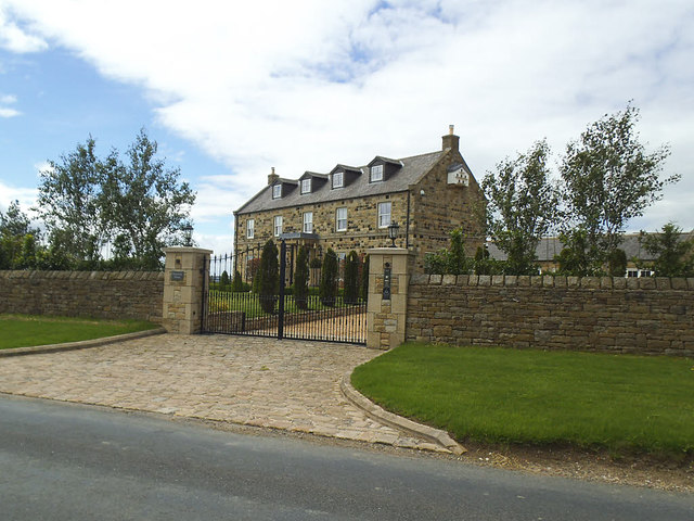
Image: © Stephen Craven Taken: 23 Jun 2020
This appears to be a new, and mock-grand name for what was previously shown on maps as Highfield House. It is a relatively modern building, not even appearing on the 1956 map, and is described on an estate agent's website as a 6 bed freehold barn conversion with 8 acres of land and a swimming pool.
Images are licensed for reuse under creativecommons.org/licenses/by-sa/2.0
Image Location


Leaflet Map data © OpenStreetMap
Latitude
53.951877
Longitude
-1.589766