Road closure on Rough Road
Introduction
The photograph on this page of Road closure on Rough Road by Stephen Craven as part of the Geograph project.
The Geograph project started in 2005 with the aim of publishing, organising and preserving representative images for every square kilometre of Great Britain, Ireland and the Isle of Man.

There are currently over 7.5m images from over 14,400 individuals and you can help contribute to the project by visiting https://www.geograph.org.uk
Road closure on Rough Road
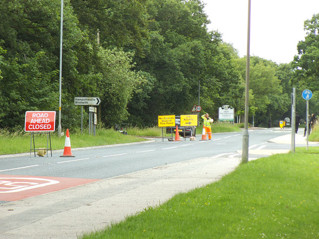
Image: © Stephen Craven Taken: 23 Jun 2020
Traffic was being diverted along Burley Bank Road to the right. The reason for the closure appeared to be that long queues were expected for the waste recycling site further along, with one side of the road being set aside for the queue (though there was none on this occasion) and the other side for through eastbound traffic and traffic leaving the recycling site.
Images are licensed for reuse under creativecommons.org/licenses/by-sa/2.0
Image Location
Latitude
53.995486
Longitude
-1.595287