Leathley Lane milepost
Introduction
The photograph on this page of Leathley Lane milepost by Stephen Craven as part of the Geograph project.
The Geograph project started in 2005 with the aim of publishing, organising and preserving representative images for every square kilometre of Great Britain, Ireland and the Isle of Man.

There are currently over 7.5m images from over 14,400 individuals and you can help contribute to the project by visiting https://www.geograph.org.uk
Leathley Lane milepost
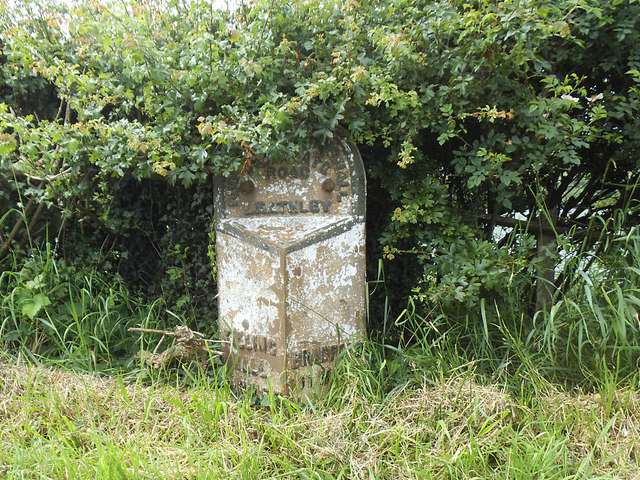
Image: © Stephen Craven Taken: 23 Jun 2020
See Image for context. The milepost is grade II listed (list entry 1315574). It reads "Dudleyhill Killinghall and Harrogate road Leathley" with distances to Killinghall 9½ miles and Bradford 11 miles. The Dudley Hill, Killinghall and Harrogate turnpike opened in 1804. See Image for another milestone on the same turnpike, seven miles further along and photographed the same day.
Images are licensed for reuse under creativecommons.org/licenses/by-sa/2.0
Image Location


Leaflet Map data © OpenStreetMap
Latitude
53.909347
Longitude
-1.640568