Whitehall College
Introduction
The photograph on this page of Whitehall College by Glyn Baker as part of the Geograph project.
The Geograph project started in 2005 with the aim of publishing, organising and preserving representative images for every square kilometre of Great Britain, Ireland and the Isle of Man.

There are currently over 7.5m images from over 14,400 individuals and you can help contribute to the project by visiting https://www.geograph.org.uk
Whitehall College
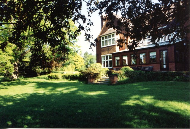
Image: © Glyn Baker Taken: 4 Jun 1991
This is the rear elevation of Whitehall College. It was once the home of the Gilbey Family (of gin fame). Before WW2 it became a girls school and in the 1970's was bought by ASTMS the Association of Scientific Technical and Managerial Staff (The Clive Jenkins Union) to become an education centre. At the time the picture was taken the Union had become MSF (Manufacturing Science & Finance). Following the merger with the AEEU in 2001 the new union Amicus found itself with two colleges on opposite sides of the M25 as the AEEU had its own college that had recently been refurbished Image The decision was made to sell Whitehall College it has now returned to luxury dwellings see Image The extension at the back was part of the college bar.
Images are licensed for reuse under creativecommons.org/licenses/by-sa/2.0
Image Location
Latitude
51.880549
Longitude
0.152556