Seaforth Highlanders South Africa Campaign Memorial
Introduction
The photograph on this page of Seaforth Highlanders South Africa Campaign Memorial by Richard Dorrell as part of the Geograph project.
The Geograph project started in 2005 with the aim of publishing, organising and preserving representative images for every square kilometre of Great Britain, Ireland and the Isle of Man.

There are currently over 7.5m images from over 14,400 individuals and you can help contribute to the project by visiting https://www.geograph.org.uk
Seaforth Highlanders South Africa Campaign Memorial
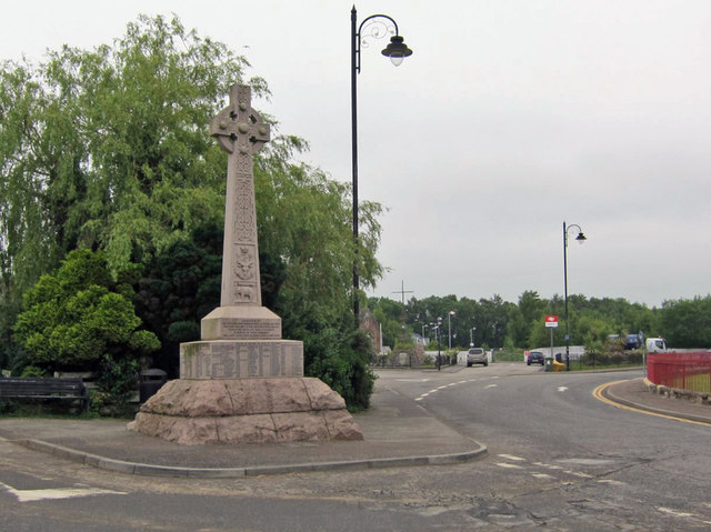
Image: © Richard Dorrell Taken: 19 Jun 2020
Located on the junction between Station Road and High Street. The memorial was unveiled on the 6th August 1904, and commemorates the Boer War; Second (1899-1902).
Images are licensed for reuse under creativecommons.org/licenses/by-sa/2.0
Image Location


Leaflet Map data © OpenStreetMap
Latitude
57.59477
Longitude
-4.423289