Once part of Chain Home radar
Introduction
The photograph on this page of Once part of Chain Home radar by Adrian S Pye as part of the Geograph project.
The Geograph project started in 2005 with the aim of publishing, organising and preserving representative images for every square kilometre of Great Britain, Ireland and the Isle of Man.

There are currently over 7.5m images from over 14,400 individuals and you can help contribute to the project by visiting https://www.geograph.org.uk
Once part of Chain Home radar
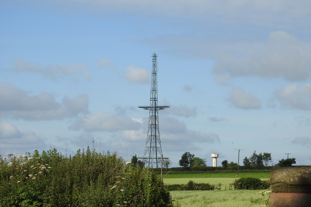
Image: © Adrian S Pye Taken: 20 Jun 2020
The mast was part of the Chain Home Radar Station at RAF Stenigot. RAF Stenigot was a Second World War radar station situated near Donington on Bain, Lincolnshire. It was part of the Chain Home radar network, intended to provide long range early warning for raids from Luftflotte 5 and the northern elements of Luftflotte 2 along the approaches to Sheffield and Nottingham and the central Midlands. After the Second World War, the site was retained as part of the Chain Home network. In 1959 it was upgraded to a communications relay site as part of the ACE High programme, which involved adding four tropospheric scatter dishes. These now lie abandoned on the site. The site was decommissioned in the late 1980s and was mostly demolished by 1996. The radar tower and Transmitter Block are Grade II listed structures
Images are licensed for reuse under creativecommons.org/licenses/by-sa/2.0
Image Location
Latitude
53.324959
Longitude
-0.114637