Big Hole in Stifford Road
Introduction
The photograph on this page of Big Hole in Stifford Road by Glyn Baker as part of the Geograph project.
The Geograph project started in 2005 with the aim of publishing, organising and preserving representative images for every square kilometre of Great Britain, Ireland and the Isle of Man.

There are currently over 7.5m images from over 14,400 individuals and you can help contribute to the project by visiting https://www.geograph.org.uk
Big Hole in Stifford Road
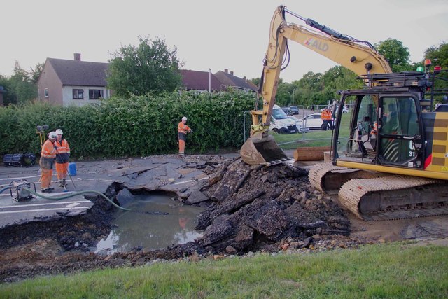
Image: © Glyn Baker Taken: 20 Jun 2020
The aftermath of a burst water main in Stifford Road. Q: What is the difference between a flood caused by a cloudburst and one caused by Essex & Suffolk Water? A: With a cloudburst sometimes you can prepare for it thanks to a weather forecast! I have to admit the crisis team did seem to arrive fairly quickly. However I am lucky my house is far enough away to be dry.
Images are licensed for reuse under creativecommons.org/licenses/by-sa/2.0
Image Location
Latitude
51.502348
Longitude
0.293331