Pen Cyn Castell - Oldcastle Down
Introduction
The photograph on this page of Pen Cyn Castell - Oldcastle Down by Alan Hughes as part of the Geograph project.
The Geograph project started in 2005 with the aim of publishing, organising and preserving representative images for every square kilometre of Great Britain, Ireland and the Isle of Man.

There are currently over 7.5m images from over 14,400 individuals and you can help contribute to the project by visiting https://www.geograph.org.uk
Pen Cyn Castell - Oldcastle Down
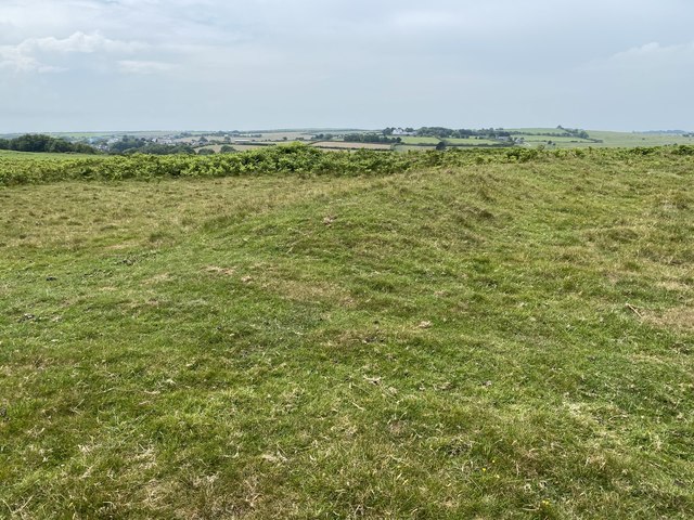
Image: © Alan Hughes Taken: 17 Jun 2020
A raised mound runs across the picture from left to right, with a slight depression left of centre where a vehicle track crosses it. I had expected it to be marked on the OS map as an Iron Age hill fort or similar ancient monument but it is not listed as such. The view across Pant St Brides is towards Tynycaia Farm with the village of St Brides visible on the left.
Images are licensed for reuse under creativecommons.org/licenses/by-sa/2.0
Image Location
Latitude
51.4698
Longitude
-3.585787