Fields north of Southway 1979
Introduction
The photograph on this page of Fields north of Southway 1979 by Crispin Purdye as part of the Geograph project.
The Geograph project started in 2005 with the aim of publishing, organising and preserving representative images for every square kilometre of Great Britain, Ireland and the Isle of Man.

There are currently over 7.5m images from over 14,400 individuals and you can help contribute to the project by visiting https://www.geograph.org.uk
Fields north of Southway 1979
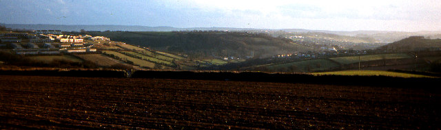
Image: © Crispin Purdye Taken: Unknown
View from the minor road that connects Tamerton Foliot and Roborough, just north east of Great Trehills farm. Winter ploughed fields and grazing land merge to residential development at Southway in the distant left of the picture, and Tamerton Foliot on the centre right. Plymouth's Crownhill in the centre far distance
Images are licensed for reuse under creativecommons.org/licenses/by-sa/2.0
Image Location


Leaflet Map data © OpenStreetMap
Latitude
50.440042
Longitude
-4.134863